Arapgir
- Tür: Kent
- Tema: Cittaslow Türkiye Şehirleri
- Kültür: Anadolu Selçuklu, Bizans, Hitit, Osmanlı, Pers, Roma, Urartu
- Yüzyıl: MÖ 15. yy
- Bölge: Türkiye, Doğu Anadolu Bölgesi, Malatya, Arapgir
Arapgir | |
|---|---|
District and municipality | |
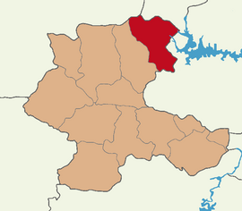
 Map showing Arapgir District in Malatya Province | |
| Coordinates: 39°02′N 38°29′E / 39.033°N 38.483°E | |
| Country | Turkey |
| Province | Malatya |
| Government | |
| • Mayor | Haluk Cömertoğlu (CHP) |
| Area | 987 km2 (381 sq mi) |
| Population (2022)[1] | 9,964 |
| • Density | 10/km2 (26/sq mi) |
| Time zone | UTC+3 (TRT) |
| Postal code | 44800 |
| Area code | 0422 |
| Website | www |
Arapgir (Armenian: Արաբկիր; Kurdish: Erebgir[2]) is a municipality and district of Malatya Province, Turkey.[3] Its area is 987 km2,[4] and its population is 9,964 (2022).[1]
It is situated at the confluence of the eastern and western Euphrates, but some miles from the right bank of the combined streams. Arapgir is connected with Sivas by a chaussée, prolonged to the Euphrates river. The present town was built in the mid-19th century, but about 2 miles north-east is the old town, now called Eskişehir ("old city" in Turkish).[5]
- ^ a b "Address-based population registration system (ADNKS) results dated 31 December 2022, Favorite Reports" (XLS). TÜİK. Retrieved 19 September 2023.
- ^ Avcıkıran, Adem (2009). Kürtçe Anamnez, Anamneza bi Kurmancî (in Kurdish and Turkish). p. 55.
- ^ Büyükşehir İlçe Belediyesi, Turkey Civil Administration Departments Inventory. Retrieved 19 September 2023.
- ^ "İl ve İlçe Yüz ölçümleri". General Directorate of Mapping. Retrieved 19 September 2023.
- ^ One or more of the preceding sentences incorporates text from a publication now in the public domain: Hogarth, David George (1911). "Arabgir". In Chisholm, Hugh (ed.). Encyclopædia Britannica. Vol. 2 (11th ed.). Cambridge University Press. p. 253.
