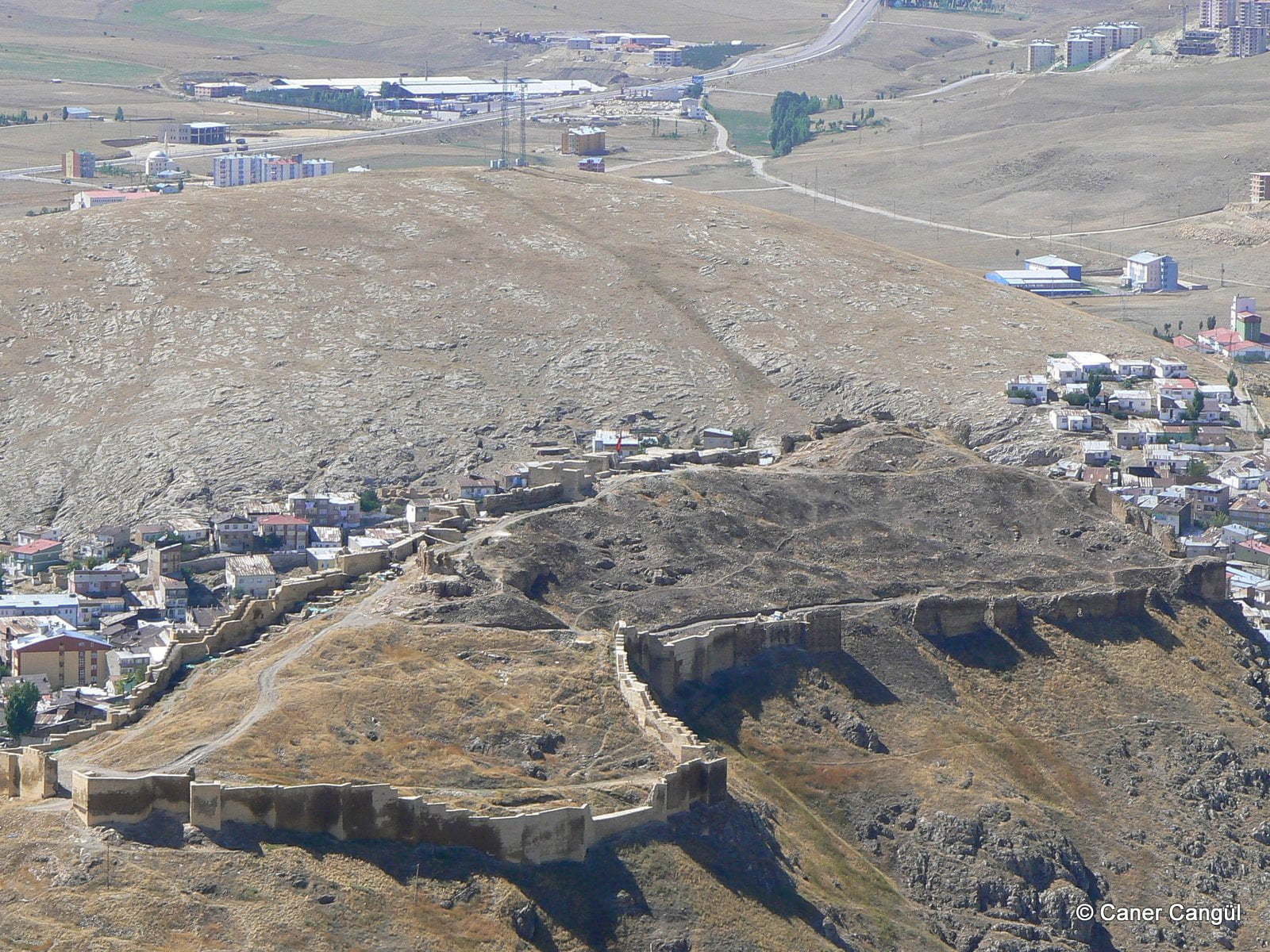
Kalenin içerisinde kiliseden çevrilme eski bir cami kalıntısı(Ebu’l Fatih camii olması muhtemel)mevcuttur.
Mehmet Demir • 2013
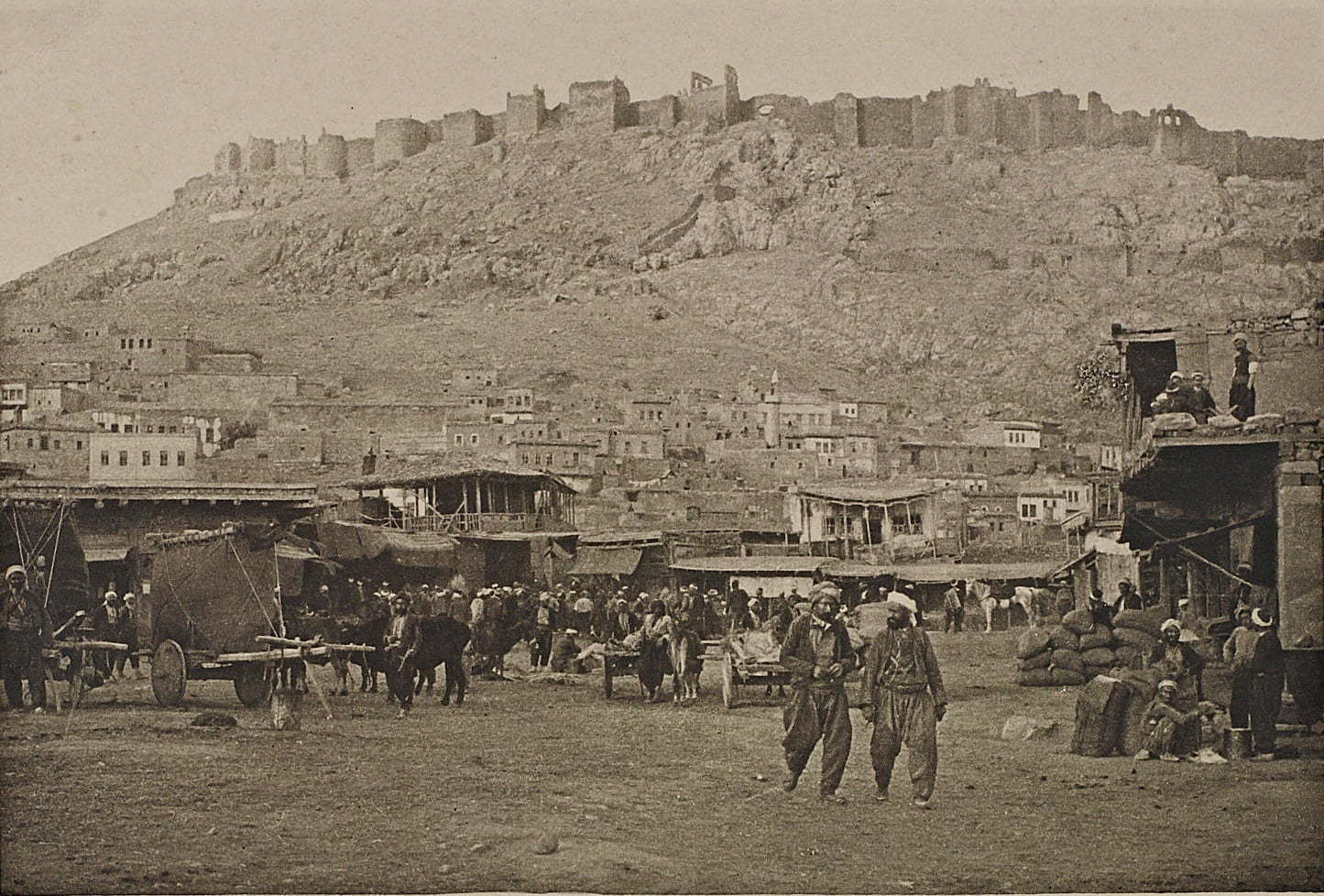
Bayburt Kalesi
- Type
- Castle
- Culture
- Anatolian Seljuk
- Century
- 8th century B.C.
- Status
- Accessible
✶ Media


✶ Related Places
Last Updated:
Ali Osman Dilekoğlu - 10:10, 10 Apr 2026
Contributor:
Ali Osman Dilekoğlu,
Caner Cangül
KE No
3041
Citation
“Bayburt Kalesi”, Kültür Envanteri, 10 April 2026,
https://kulturenvanteri.com/en/?p=3041 .