Caner Cangül • 2016 • CC BY-NC-ND 4.0
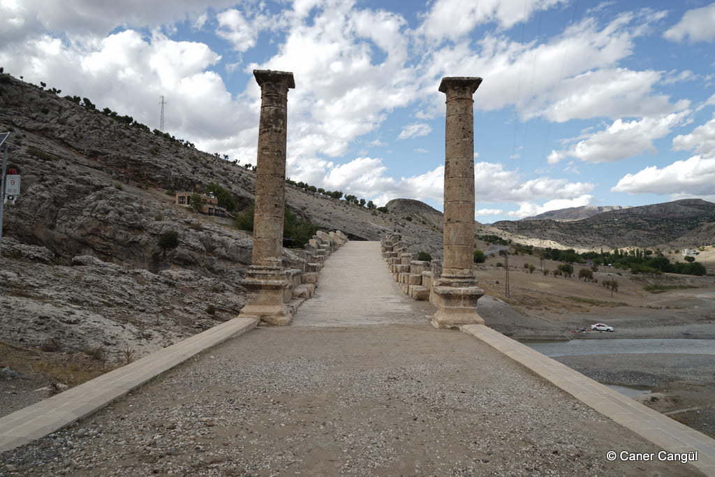
Cendere Köprüsü
Also known as Septimius Severus Köprüsü.
- Type
- Bridge
- Culture
- Rome
- Century
- 2nd century
- Status
- Accessible
✶ Media


Last Updated:
Caner Cangül - 11:09, 17 Mar 2026
Contributor:
Murat Kurtel,
Caner Cangül
KE No
3451
Citation
“Cendere Köprüsü”, Kültür Envanteri, 17 March 2026,
https://kulturenvanteri.com/en/?p=3451 .